Ville de Anna Paulowna (Noord-Holland)
Informations
Chiffres
- Code pays :
- NL
- Code postal :
- 1761-AA
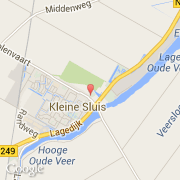
- Latitude :
- 52.86255
- Longitude :
- 4.83443
- Zone horaire :
- Europe/Amsterdam
- Fuseau horaire :
- UTC+1
- Heure d'été :
- Y
La ville de Anna Paulowna appartient à la province Noord-Holland et à la municipalité Anna Paulowna.
La ville de Anna Paulowna s'étend sur 77,56 km² et compte 14 019 habitants (recensement de 2007) pour une densité de 180,75 habitants par km².
Le maire de la ville de Anna Paulowna est actuellement A.J. Pennink.
Le nom français de la ville est Anna Paulowna.
Le site Internet de Anna Paulowna est http://www.annapaulowna.nl
©photo-libre.fr