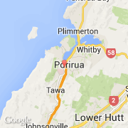
Ville de Porirua (Wellington)
Informations
Chiffres
- Code pays :
- NZ
- Code postal :
- 5022
- Latitude :
- -41.13840
- Longitude :
- 174.84100
- Zone horaire :
- Pacific/Auckland
- Fuseau horaire :
- UTC+12
- Heure d'été :
- Y
La ville de Porirua appartient à la région Wellington et au territoire Porirua.
La ville de Porirua s'étend sur 182,39 km² et compte 48 546 habitants (recensement de 2011) pour une densité de 266,17 habitants par km².
Le maire de la ville de Porirua est actuellement Nick Leggett.
Le nom français de la ville est Porirua, le nom espagnol est Porirua.
Le site Internet de Porirua est http://www.pcc.govt.nz
©photo-libre.fr