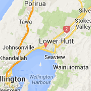
Ville de Petone (Wellington)
Informations
Chiffres
- Code pays :
- NZ
- Code postal :
- 5012
- Latitude :
- -41.22547
- Longitude :
- 174.87915
- Zone horaire :
- Pacific/Auckland
- Fuseau horaire :
- UTC+12
- Heure d'été :
- Y
La ville de Petone appartient à la région Wellington et au territoire Hutt.
La ville de Petone compte 6 609 habitants (recensement de 2006).
Le nom français de la ville est Petone, le nom anglais de la ville est Petone.
©photo-libre.fr