Ville de Tzintzuntzan (Michoacán de Ocampo)
Informations
Chiffres
- Code pays :
- MX
- Code postal :
- 58440
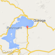
- Latitude :
- 19.62672
- Longitude :
- -101.57699
- Zone horaire :
- America/Mexico_City
- Fuseau horaire :
- UTC-6
- Heure d'été :
- Y
La ville de Tzintzuntzan appartient à l'état Michoacán de Ocampo et à la commune Tzintzuntzan.
©photo-libre.fr