Ville de Texcaltenco (Distrito Federal)
Informations
Chiffres
- Code pays :
- MX
- Code postal :
- 14426
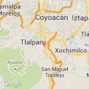
- Latitude :
- 19.26388
- Longitude :
- -99.17651
- Zone horaire :
- America/Mexico_City
- Fuseau horaire :
- UTC-6
- Heure d'été :
- Y
La ville de Texcaltenco appartient à l'état Distrito Federal et à la commune Tlalpan.
©photo-libre.fr