Ville de Río Lerma (México)
Informations
Chiffres
- Code pays :
- MX
- Code postal :
- 50456
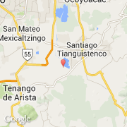
- Latitude :
- 19.14653
- Longitude :
- -99.50339
- Zone horaire :
- America/Mexico_City
- Fuseau horaire :
- UTC-6
- Heure d'été :
- Y
La ville de Río Lerma appartient à l'état México et à la commune Atlacomulco.
Le nom français de la ville est Río Lerma.
©photo-libre.fr