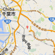
Ville de Chiba (Kantō)
Informations
Chiffres
- Code pays :
- JP
- Code postal :
- 260-0804
- Latitude :
- 35.57495
- Longitude :
- 140.16769
- Zone horaire :
- Asia/Tokyo
- Fuseau horaire :
- UTC+9
- Heure d'été :
- N
La ville de Chiba appartient à la région Kantō, à la préfecture Chiba, au district Chiba et à l'agglomération Chūō.
La ville de Chiba s'étend sur 272,08 km² et compte 959 357 habitants (recensement de 2010) pour une densité de 3 526,01 habitants par km².
Le maire de la ville de Chiba est actuellement Toshihito Kumagai.
Le nom français de la ville est Chiba-shi.
Le site Internet de Chiba est http://www.city.chiba.jp
©photo-libre.fr