Ville de Rajkot (Chattisgarh)
Informations
Chiffres
- Code pays :
- IN
- Code postal :
- 496115
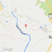
- Latitude :
- 21.93830
- Longitude :
- 83.25530
- Zone horaire :
- Asia/Kolkata
- Fuseau horaire :
- UTC+5:30
- Heure d'été :
- N
La ville de Rajkot appartient à l'état Chattisgarh, au district Raigarh et au sous-district Raigarh.
La ville de Rajkot s'étend sur 170,00 km² et compte 1 335 397 habitants (recensement de 2012) pour une densité de 7 855,28 habitants par km². L'altitude moyenne est de 134 m.
La ville de Rajkot a été fondée en 1973.
©photo-libre.fr