Ville de La Chapelle-Péchaud (Aquitaine)
Informations
Chiffres
- Code pays :
- FR
- Code postal :
- 24250
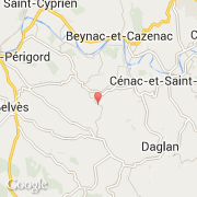
- Latitude :
- 44.77927
- Longitude :
- 1.11495
- Zone horaire :
- Europe/Paris
- Fuseau horaire :
- UTC+1
- Heure d'été :
- Y
Informations
Chiffres
Villes voisines
Les transports de La Chapelle-Péchaud
Informations
Chiffres
Villes voisines
Les transports de La Chapelle-Péchaud