Ville de Union (Connecticut)
Informations
Chiffres
- Code pays :
- US
- Code postal :
- 06076
- Latitude :
- 41.98512
- Longitude :
- -72.25566
- Zone horaire :
- America/New_York
- Fuseau horaire :
- UTC-5
- Heure d'été :
- Y
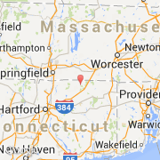
La ville de Union appartient à l'état Connecticut et au comté Tolland.
La ville de Union s'étend sur 77,2 km² et compte 693 habitants (recensement de 2000) pour une densité de 8,98 habitants par km². L'altitude moyenne est de 299 m.
Le maire de la ville de Union est actuellement Andy Goodall.
Le nom espagnol est Union.
La ville de Union a été fondée en 1734. Le site Internet de Union est http://www.unionconnecticut.org
©photo-libre.fr