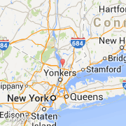
Ville de Tarrytown (New York)
Informations
Chiffres
- Code pays :
- US
- Code postal :
- 10591
- Latitude :
- 41.07811
- Longitude :
- -73.85529
- Zone horaire :
- America/New_York
- Fuseau horaire :
- UTC-5
- Heure d'été :
- Y
La ville de Tarrytown appartient à l'état New York et au comté Westchester.
La ville de Tarrytown s'étend sur 14,7 km² et compte 11 277 habitants (recensement de 2010) pour une densité de 767,14 habitants par km². L'altitude moyenne est de 37 m.
Le site Internet de Tarrytown est http://www.tarrytowngov.com
©photo-libre.fr