Ville de Randallstown (Maryland)
Informations
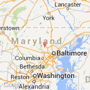
Chiffres
- Code pays :
- US
- Code postal :
- 21133
- Latitude :
- 39.37539
- Longitude :
- -76.80543
- Zone horaire :
- America/New_York
- Fuseau horaire :
- UTC-5
- Heure d'été :
- Y
Informations
Chiffres
Villes voisines
Les transports de Randallstown
Informations
Chiffres
Villes voisines
Les transports de Randallstown