Ville de Pearl River (New York)
Informations
Chiffres
- Code pays :
- US
- Code postal :
- 10965
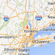
- Latitude :
- 41.06320
- Longitude :
- -74.01992
- Zone horaire :
- America/New_York
- Fuseau horaire :
- UTC-5
- Heure d'été :
- Y
La ville de Pearl River appartient à l'état New York et au comté Rockland.
La ville de Pearl River s'étend sur 18,6 km² et compte 15 876 habitants (recensement de 2010) pour une densité de 853,55 habitants par km². L'altitude moyenne est de 73 m.
Le nom français de la ville est Rivière aux Perles.
Le surnom de la ville est "The Town of Friendly People".
©photo-libre.fr