Ville de Lopez Island (Washington)
Informations
Chiffres
- Code pays :
- US
- Code postal :
- 98261
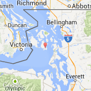
- Latitude :
- 48.44611
- Longitude :
- -122.84180
- Zone horaire :
- America/Los_Angeles
- Fuseau horaire :
- UTC-8
- Heure d'été :
- Y
La ville de Lopez Island appartient à l'état Washington et au comté San Juan.
Le nom espagnol est Lopez Island.
©photo-libre.fr