Ville de Joppa (Maryland)
Informations
Chiffres
- Code pays :
- US
- Code postal :
- 21085
- Latitude :
- 39.43243
- Longitude :
- -76.35525
- Zone horaire :
- America/New_York
- Fuseau horaire :
- UTC-5
- Heure d'été :
- Y
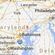
La ville de Joppa appartient à l'état Maryland et au comté Harford.
La ville de Joppa s'étend sur 51,76 km² et compte 392 500 habitants (recensement de 2008) pour une densité de 7 583,08 habitants par km². L'altitude moyenne est de 040 m.
Le nom français de la ville est Jaffa.
Le site Internet de Joppa est http://www.tel-aviv.gov.il
©photo-libre.fr