Ville de Healdton (Oklahoma)
Informations
Chiffres
- Code pays :
- US
- Code postal :
- 73438
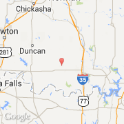
- Latitude :
- 34.22823
- Longitude :
- -97.48377
- Zone horaire :
- America/Chicago
- Fuseau horaire :
- UTC-6
- Heure d'été :
- Y
Informations
Chiffres
Villes voisines
Informations
Chiffres
Villes voisines