Ville de Green Lane (Pennsylvania)
Informations
Chiffres
- Code pays :
- US
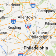
- Code postal :
- 18054
- Latitude :
- 40.34252
- Longitude :
- -75.43891
- Zone horaire :
- America/New_York
- Fuseau horaire :
- UTC-5
- Heure d'été :
- Y
La ville de Green Lane appartient à l'état Pennsylvania et au comté Montgomery.
La ville de Green Lane s'étend sur 0,9 km² et compte 508 habitants (recensement de 2010) pour une densité de 564,44 habitants par km². L'altitude moyenne est de 73 m.
Le nom anglais de la ville est Borough of Green Lane, le nom espagnol est Green Lane.
©photo-libre.fr