Ville de Great Neck (New York)
Informations
Chiffres
- Code pays :
- US
- Code postal :
- 11020
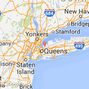
- Latitude :
- 40.78579
- Longitude :
- -73.72600
- Zone horaire :
- America/New_York
- Fuseau horaire :
- UTC-5
- Heure d'été :
- Y
La ville de Great Neck appartient à l'état New York et au comté Nassau.
La ville de Great Neck s'étend sur 3,5 km² et compte 9 538 habitants (recensement de 2010) pour une densité de 2 725,14 habitants par km². L'altitude moyenne est de 33 m.
Le nom anglais de la ville est Great Neck, le nom espagnol est Nueva York.
Le surnom de la ville est "The Old Village". Le site Internet de Great Neck est http://www.greatneckvillage.org
©photo-libre.fr