Ville de Fort Hancock (New Jersey)
Informations
Chiffres
- Code pays :
- US
- Code postal :
- 07732
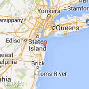
- Latitude :
- 40.40004
- Longitude :
- -73.99086
- Zone horaire :
- America/New_York
- Fuseau horaire :
- UTC-5
- Heure d'été :
- Y
La ville de Fort Hancock appartient à l'état New Jersey et au comté Monmouth.
La ville de Fort Hancock s'étend sur 49,74 km² et compte 1 750 habitants (recensement de 2010) pour une densité de 35,18 habitants par km². L'altitude moyenne est de 1 089 m.
Le nom anglais de la ville est Fort Hancock and the Sandy Hook Proving Ground Historic District, le nom espagnol est Fort Hancock.
Le site Internet de Fort Hancock est http://tps.cr.nps.gov
©photo-libre.fr