Ville de Dry Ridge (Kentucky)
Informations
Chiffres
- Code pays :
- US
- Code postal :
- 41035
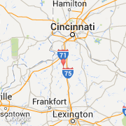
- Latitude :
- 38.70460
- Longitude :
- -84.65520
- Zone horaire :
- America/Kentucky/Louisville
- Fuseau horaire :
- UTC-5
- Heure d'été :
- Y
Informations
Chiffres
Villes voisines
Les transports de Dry Ridge
Informations
Chiffres
Villes voisines
Les transports de Dry Ridge