Ville de Koglhof (Steiermark)
Informations
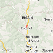
Chiffres
- Code pays :
- AT
- Code postal :
- 8191
- Latitude :
- 47.31973
- Longitude :
- 15.69034
- Zone horaire :
- Europe/Vienna
- Fuseau horaire :
- UTC+1
- Heure d'été :
- Y
La ville de Koglhof appartient à l'état Steiermark et au district Weiz.
La ville de Koglhof s'étend sur 30,29 km² et compte 1 137 habitants pour une densité de 37,54 habitants par km². L'altitude moyenne est de 600 m.
Le maire de la ville de Koglhof est actuellement Rudolf Grabner (ÖVP).
Le nom français de la ville est Koglhof, le nom anglais de la ville est Koglhof.
©photo-libre.fr