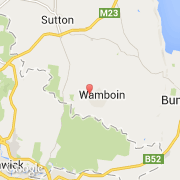
Ville de Wamboin (New South Wales)
Informations
Chiffres
- Code pays :
- AU
- Code postal :
- 2620
- Latitude :
- -35.24969
- Longitude :
- 149.29825
- Zone horaire :
- Australia/Sydney
- Fuseau horaire :
- UTC+10
- Heure d'été :
- Y
La ville de Wamboin appartient à l'état New South Wales et à la région Canberra.
La ville de Wamboin compte 1 672 habitants.
Le nom anglais de la ville est Wamboin.
©photo-libre.fr