Ville de Rangeway (Western Australia)
Informations
Chiffres
- Code pays :
- AU
- Code postal :
- 6530
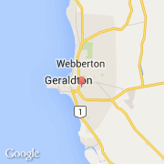
- Latitude :
- -28.78389
- Longitude :
- 114.62956
- Zone horaire :
- Australia/Perth
- Fuseau horaire :
- UTC+8
- Heure d'été :
- Y
La ville de Rangeway appartient à l'état Western Australia et à la région Kalgoorlie.
La ville de Rangeway s'étend sur 1,6 km² et compte 2 303 habitants pour une densité de 1 439,38 habitants par km².
Le nom anglais de la ville est Rangeway.
©photo-libre.fr