Ville de Nedlands (Western Australia)
Informations
Chiffres
- Code pays :
- AU
- Code postal :
- 6009
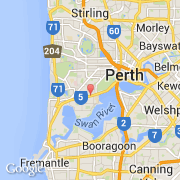
- Latitude :
- -31.97801
- Longitude :
- 115.81002
- Zone horaire :
- Australia/Perth
- Fuseau horaire :
- UTC+8
- Heure d'été :
- Y
La ville de Nedlands appartient à l'état Western Australia et à la région Curtin.
La ville de Nedlands s'étend sur 5,3 km² et compte 10 184 habitants pour une densité de 1 921,51 habitants par km².
Le nom anglais de la ville est State Suburbs Nedlands.
©photo-libre.fr