Ville de Kensington Park (South Australia)
Informations
Chiffres
- Code pays :
- AU
- Code postal :
- 5068
- Latitude :
- -34.92643
- Longitude :
- 138.65107
- Zone horaire :
- Australia/Adelaide
- Fuseau horaire :
- UTC+9:30
- Heure d'été :
- Y
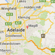
La ville de Kensington Park appartient à l'état South Australia et à la région SA Subs Near 1.
La ville de Kensington Park s'étend sur 3,44 km² et compte 2 498 habitants (recensement de 2010) pour une densité de 726,16 habitants par km². L'altitude moyenne est de 8 m.
Le nom anglais de la ville est Kensington Park, le nom espagnol est Kensington Park.
©photo-libre.fr