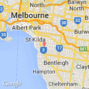
Ville de Elsternwick (Victoria)
Informations
Chiffres
- Code pays :
- AU
- Code postal :
- 3185
- Latitude :
- -37.88472
- Longitude :
- 145.00415
- Zone horaire :
- Australia/Melbourne
- Fuseau horaire :
- UTC+10
- Heure d'été :
- Y
Informations
Chiffres
Villes voisines
Les transports de Elsternwick
Informations
Chiffres
Villes voisines
Les transports de Elsternwick