Ville de Casterton (Victoria)
Informations
Chiffres
- Code pays :
- AU
- Code postal :
- 3311
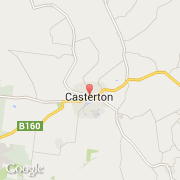
- Latitude :
- -37.58421
- Longitude :
- 141.40594
- Zone horaire :
- Australia/Melbourne
- Fuseau horaire :
- UTC+10
- Heure d'été :
- Y
La ville de Casterton appartient à l'état Victoria et à la région Far Country.
La ville de Casterton compte 1 425 habitants.
Le nom anglais de la ville est Casterton.
©photo-libre.fr