Ville de Hoppegarten (Brandenburg)
Informations
Chiffres
- Code pays :
- DE
- Code postal :
- 15366
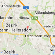
- Latitude :
- 52.51794
- Longitude :
- 13.64961
- Zone horaire :
- Europe/Berlin
- Fuseau horaire :
- UTC+1
- Heure d'été :
- Y
La ville de Hoppegarten appartient à l'état Brandenburg et au district Märkisch-Oderland.
La ville de Hoppegarten s'étend sur 31,88 km² et compte 16 684 habitants (recensement de 2009) pour une densité de 523,34 habitants par km². L'altitude moyenne est de 50 m.
Le bourgemestre de la ville de Hoppegarten est actuellement Klaus Ahrens (Union chrétienne-démocrate d'Allemagne).
Le nom français de la ville est Hoppegarten.
Le site Internet de Hoppegarten est http://www.hoppegarten.de
©photo-libre.fr