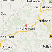
Ville de Hohenwart (Bayern)
Informations
Chiffres
- Code pays :
- DE
- Code postal :
- 86558
- Latitude :
- 48.59231
- Longitude :
- 11.38224
- Zone horaire :
- Europe/Berlin
- Fuseau horaire :
- UTC+1
- Heure d'été :
- Y
La ville de Hohenwart appartient à l'état Bayern, au comté Oberbayern et au district Pfaffenhofen an der Ilm.
La ville de Hohenwart s'étend sur 52,21 km² et compte 4 345 habitants pour une densité de 83,22 habitants par km². L'altitude moyenne est de 395 m.
Le bourgemestre de la ville de Hohenwart est actuellement Manfred Russer.
Le nom français de la ville est Hohenwart.
Le site Internet de Hohenwart est http://www.markt-hohenwart.de
©photo-libre.fr