Ville de Gartow (Brandenburg)
Informations
Chiffres
- Code pays :
- DE
- Code postal :
- 16845
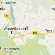
- Latitude :
- 52.88645
- Longitude :
- 12.51745
- Zone horaire :
- Europe/Berlin
- Fuseau horaire :
- UTC+1
- Heure d'été :
- Y
La ville de Gartow appartient à l'état Brandenburg et au district Ostprignitz-Ruppin.
La ville de Gartow s'étend sur 28,28 km² et compte 1 382 habitants pour une densité de 48,87 habitants par km². L'altitude moyenne est de 17 m.
Le bourgemestre de la ville de Gartow est actuellement Hans-Udo Maury (Christlich Demokratische Union).
Le site Internet de Gartow est http://www.gartow.de
©photo-libre.fr